| |
|
|
Origin of the Tyuratam test site
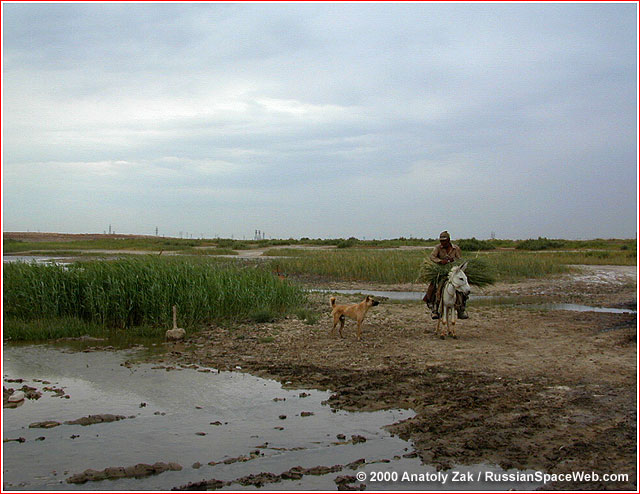
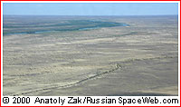
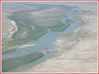
A shore of the Syr Darya river next to the so-called Site 0, where the residential area of Baikonur Cosmodrome was founded in 1955. To the new arrivals, the site of the future space center often looked as an inhospitable and uninhabitable desert. Yet in reality, the sprawling launch facility had to co-exist with an ancient world of the steppes for decades to come. This clash of cultures would be captured in a novel by Chinghiz Aitmatov "Buranny Polustanok" (Snowstorm Junction). Test site dilemma In mid-1950s, the Soviet rocket engineers raced to develop the first intercontinental missiles — ballistic R-7 and winged Burya. They both required a new test site, since the location of the existing proving ground in Kapustin Yar on the Volga River would not allow "fitting" the flight range of missiles exceeding 1,000-1,500 kilometers. The major requirement for the new test range was dictated by radio-control developers, who needed to deploy an array of guidance antennas, which would have unobstructed "view" of the rocket over hundreds of miles during powered phase of the flight. Although the Soviet military has had a privilege of selecting test sites in the past, Sergei Korolev, the head of OKB-1 developing the first ICBM, hoped to influence the decision-making process this time. Korolev advised his deputies Voskresensky and Chertok to get involved in the search, if they, as Korolev put it, "don't want to end up beyond the Arctic Circle." Korolev's associates armed with maps did their own "desktop reconnaissance," starting with the region adjacent to the familiar Kapustin Yar and plotting an 8,000-km trajectory eastward to Kamchatka. They soon saw for themselves that booster stages of a missile like R-7 would fall in populated areas, while one of radio control stations would end up in the Caspian Sea or Iran. Planners then "moved" to the Stavropol Region, west of the Caspian Sea, the area of soft climate and popular Russian resorts. To the satisfaction of Korolev's deputies, the booster stages would now fall in the Caspian Sea. However, this idea was immediately ridiculed by the radio-control experts. Ryazansky, the man in charge of flight control system development, reportedly, joked in the phone conversation with Korolev, that he as much as Chertok and Voskresensky would love to fire missiles from Miniralny Vody (a popular Russian resort), however his radio stations can't work over "crowding maintains" of Caucus. Soon, Korolev informed his deputies that they could wrap up their "amateurism," because the government had formed a special commission to deal with the issue. (58) The search On March 17, 1954, Soviet of Ministers USSR issued a decree assigning Ministry of Defense, Ministry of Medium Machine Building, Ministry of Defense Industry, Ministry of Radiotechnical Industry and Ministry of Aviation Industry to conduct a search for a test site for long-range missiles by January 1, 1955, and report their proposals to the government by March 1, 1955. (51) Vasili Voznuk, the current chief of Kapustin Yar led the special search commission. By the time the commission was formed, NII-4, the central research institute of the Soviet defense ministry led by General Nesterenko, had already conducted a yearlong preliminary study on the organization of the testing for long-range missiles. G. A. Tyulin, deputy director of the NII-4 institute, and the chief of the theoretical department of Chief Artillery Directorate, GAU, oversaw this research. Post-Cold War sources identified many locations, which were under consideration for the R-7 testing. According to a veteran of the NII-4 research institute, he was assigned to study flight trajectories for the R-7, originating near the town of Krasnovodsk in the Republic of Turkmenia and the station of Dzhusaly in Kazakhstan with an impact zone in the Kamchatka Peninsula, as well as the launch site near the town of Konosha in the Arkhagelsk Region with an impact zone on the Wrangel Island. According to the official history of RKK Energia, (52) the military commission also eyed huge timber clearings left after World War II in Mari Autonomous Region, east of the city of Gorkiy. The idea was abandoned, reportedly, (18) after Korolev insisted on choosing the site as far south as possible in order to increase the range of the missiles with assistance from Earth's rotation. The commission also tried "to land" the range on the west coast of the Caspian Sea in Daghestan or near the city of Kharabali in Astrakhan Region on the Volga River. Both places were easily accessible by all means of transportation both had moderate climate and could fit the trajectory of the long-range missiles. Those locations were also dropped over objections by Ryazansky, the head of the R-7 control system development. In the retrospect, Chertok criticized the decision to reject Caspian locations given the fact that radio-control system itself was soon to be abandoned in favor of inertial systems. (58, 52) Case for Tyuratam Despite the attractiveness of other sites, at the time, the planners had to agree to the least attractive option from all but radio-control engineers' point of view: the right bank of the Syr Darya River in Kazakhstan between towns of Kazalinsk and Dzhusaly. This sparsely populated and remote region was linked to industrial centers of Russia, by the Kazakhstanskaya Railroad (later renamed Western-Kazakhstan Railroad). According to a CIA veteran, who participated in the search for the new Soviet test range, at the Tyuratam junction, a single rail line was branching from the main railway, heading 28 kilometers into the steppe toward an open pit mine, which could, theoretically, be used as a flame deflector of a future launch pad. (115) The western sources also suggested the mine was originally excavated by the GULAG prisoners. (34) However, the Russian veterans of the early test range construction in Tyuratam insist that the flame trench for the first launch pad was excavated from scratch. (51) The official history of RKK Energia confirmed that the rail spur and the quarry existed prior to the foundation of the missile range. (52) In fact, according to this source, the existence of the spur was one of the factors, the Tyuratam junction was selected as the site of the future missile range. According to another veteran, the original narrow-gauge rail line from Tyuratam junction to the site of the future launch pad had been dismantled before the foundation of the test range, but its rail bed remained. (847) In any case, even with the railway in place, the good news would end there. The climate in the region featured dust storms and temperatures up to 50C degrees in the summer, snowstorms and cold as low as minus 25C degrees in the winter. Health service also warned about the danger of plague in the area spread by numerous rodents. Practically no infrastructure or housing was available. (58) According to Golovanov, Voznyuk consulted with Ryazansky, Barmin (launch complex developer) and Korolev. The latter was, reportedly, strongly in favor of the Kazakhstan site. (18) In the contrary, Heppenheimer makes a claim, with no reference to any source, that "Korolev had placed this site at the bottom of his list of choices, but he was overruled." (28) In January 1955, a special surveillance team of the NII-4 institute and led by General Voznyuk was dispatched to the nearby station of Dzhusaly. Equipped with off-road vehicles, the group conducted surveillance trips in the surrounding areas. At the Tyuratam station, the team found three sidings, a water tower and three one-floor buildings. According to one account, the members of the group stuck a piece of rail at the site of the future launch pad. (82) Voznyuk made his recommendations on the Kazakh site to Marshall of Artillery Nedelin, overseeing the missile development program for the Ministry of Defense. In his turn, Nedelin announced the findings at the top-secret meeting at Dzerzhinsky Academy of Military Engineering to a number of high-ranking officials among them Lieutenant General Grigorenko, the chief of Main Directorate of Special Construction for the Ministry of Defense (GUSS MO). The latter, apparently, was less than excited about the prospect of building an expansive facility in the remote and inhospitable region, however had no other choice but to comply. (18) As an odd sign of things to come, the Soviet of Ministers of Kazakhstan was suspiciously slow to approve the transfer of lands over to the Soviet Ministry of Defense, the procedure seen by Russian officials as a "pure formality." It took Korolev's visit to Central Committee of the Communist Party of Kazakhstan in Alma-Ata and a call from one of the Central Committee members to the Soviet of Ministers of the Kazakh Republic to get "formal" paperwork signed. Organization and responsibilities The general development of the Tyuratam project was delegated to the Central Design Institute of the Special Construction of the Ministry of Defense (TsIPSS MO) in Moscow. The institute's veteran Alexei Nitochkin, the author of the Kapustin Yar layout, was appointed a chief-engineer of the Tyuratam range development. The institute was a design arm of Main Directorate of Special Construction of the Ministry of Defense (GUSS MO), which in its turn reported to the Deputy Defense Minister for Military Construction and Housing. (51) By the end of 1954, GUSS MO has already finalized the following structure and responsibilities for the development of the Tyuratam site: 1. Chief planning and development organization: 130th Directorate of Engineering Works (130 UIR) headed by Lt. Colonel Georgiy Shubnikov. 2. Construction organizations:
Also with permission of I. Kurchatov, the head of the Soviet nuclear program, the experienced team of 217th detached engineering and mining battalion (OISB) from Semipalatinsk nuclear test range would be transferred to Tyuratam to assist with the construction of the crucial facilities; The findings made by Voznyuk commission and the formal proposal to the government to develop the site in Kazakhstan were officially presented in the memo issued on February 4, 1955. It was signed by Ministers Malushev, Zhukov, Dementiev, Domrachev and Kalmykov. The decision was finalized during one of the Politburo meetings at the beginning of 1955. In the course of the meeting, Marshall Zhukov went through the formality of naming the sites under consideration and proposed Kazakhstan. Nobody questioned Zhukov's judgment and vote was routine and unanimous. According to Golovanov, Khrushchev, was the only person among those present at the meeting, who asked where exactly the new test range would be situated. "Tyuratam junction," Zhukov replied. (18) On February 12, 1955, Soviet of Ministers USSR issued a decree No. 292-181 entitled "On the new test site of the Ministry of Defense of the USSR": The text of the document read: The Soviet of Ministers USSR decrees: 1. To accept proposals by comrades Malyshev, Zhukov, Vasilevskiy, Dementiev, Domrachev and Kalmykov: a) On creation in 1955-1958 scientific-research and test range of Ministry of Defense USSR for flight testing articles R-7, Burya, and Buran with establishing:
b) On conducting the first phase of testing Burya and Buran vehicles at reduced range from the territory of scientific-test range #4 of the Ministry of Defense USSR from the region Vladimirovka of Astrakhan Region in the direction of Balkhash Lake. 2. To assign comrades Malyshev, Saburov and Zhukov in three weeks present in the Soviet of Ministers list of activities for organization and construction above-mentioned test range. The Chairman of the Soviet of Ministers USSR N. Bulganin The Operational Director of the Soviet of Ministers USSR A. Korobov. This list also determined place, organization, volume and deadlines for the construction of the range and its cost. The site was officially named Scientific Research Test Range No. 5 (NIIP-5). In April 1955, Marshal Nedelin, who had official rank of the Deputy to the Minister of Defense for Special Armaments, appointed General Alexei Nesterenko to be a chief of yet-to-be-built missile range in Tyuratam. Colonel A.I. Nosov became Nesterenko's deputy for experimental and testing works, and Colonel A.A. Vasiliev, the deputy for scientific and research works. Nesterenko's test units meant to be actual users of the range. However, the chief of construction Shubnikov, who reported directly to Deputy Minister of Defense for Military Construction and Housing, bypassing Nesterenko and Nedelin, became a de-facto czar in Tyuratam in the first years. Several other branches of the Soviet Ministry of Defense were also directly involved in NIIP-5 operations. Deputy Minister of Defense for Communications oversaw the deployment of a vast network of phone lines and radio-transmitting equipment at the range, while the Air Force commander (who was also Deputy to the Minister of Defense) would manage the airport serving Tyuratam. The Ministry of Transportation Lines and Army's Railroad Forces were responsible for construction and maintenance of rail lines of NIIP-5. Finally, Kazakhenergo, Kazakhstan energy authority, had to build network of power lines to supply the range with electricity. In the interim, special fuel-generator trains would serve the range. (58) On June 2, 1955, Chief of Staff of the Soviet Ministry of Defense approved the organizational structure of a new test range near Tyuratam. This date would later become an official "birthday" of Baikonur Cosmodrome. Origin of the town of Tyuratam When Tyuratam's origin could be openly examined in the 1990s by the post-Soviet authors, the center has already became a hot political issue between Russia and Kazakhstan. Not surprisingly, the town's past, (as well as the rest of Kazakh history), looked different from two nations' perspectives. According to Kazakh sources, Tyura-Tam originated as a settlement of cattle growers and its history was rooted deep into the antiquity. In contrast, Russian authors tended to "nationalize" the origin of many Kazakh locations, including that of Tyuratam. Yaroslav Golovanov, in a chapter on Tyuratam's origin in his biography of Sergei Korolev, completely ignored the existence of a Kazakh settlement that gave this non-Russian name to the future test range. Golovanov dates the foundation of Tyuratam to 1901, when a water pump was established at the site to refill steam engines on a newly constructed railroad, which connected Russian city of Orenburg to the north with Uzbek city of Tashkent to the south. According to Golovanov, since 1913, rotating teams of "Russian mechanics" had lived permanently in Tyuratam. He estimates the population of the village by the beginning of 1955 at "several dozen" people, living in around 30 houses. (18) Golovanov, as majority of Russian authors, didn't mention that before the missile range was founded, a 28-kilometer rail spur was branching out from the Tyuratam station, leading 28 kilometers into the steppe toward a mine pit. Nevertheless, Golovanov referred to Tyuratam as a "junction." Tyuratam's spur was old enough to appear on the German military maps prepared around 1939, on the eve of the Nazi invasion of the Soviet Union.
|
|