| |
|
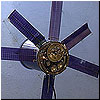
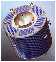
Sfera geodesic satellite
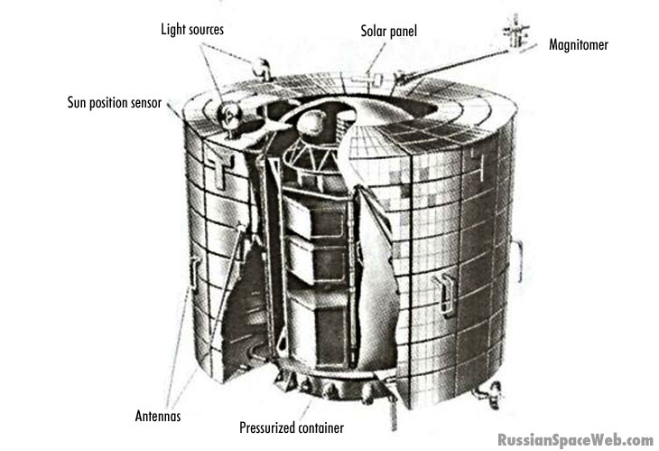
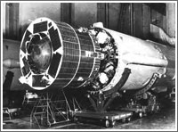
In planning global strikes during the Cold War, the Soviet military needed very accurate maps and precise navigational data. Among the factors affecting geographic accuracy were minute variations in the shape of the Earth and its gravitational field. To create a space-age beacon for military cartographers, in 1965, NPO PM design bureau started development of a specialized satellite on specifications from the Ministry of Defense. Code-named Geoid-Sfera, the spacecraft was equipped with a special flashing light, which enabled three or four astronomical and geodetic centers of the Military Topographic Directorate within the Soviet Chief of Staff to simultaneously photograph the satellite's position relative to stars with an accuracy of 3-6 arc seconds. Thanks to this data, positions of points located at great distances from each other could be determined with a precision of 25-30 meters. (457) Sfera also carried a special radio transmitter which allowed to determine the satellite's velocity with an accuracy of 0.1 meter per second by measuring the Doppler shift of the signal. (455) This information was used for calculating point position of ground targets. The first Sfera satellite launch took place in Plesetsk on Feb. 20, 1968, under the official name Kosmos-203. (66) Sfera satellites were typically inserted into a 1,200-kilometer circular orbit with an inclination 74 degrees toward the Equator. Such an altitude helped to essentially eliminate the influence of the atmosphere on the satellite, so that any variations of its orbit could be attributed to the gravitational field of the Earth. Although the first Sfera satellite operated for 19 months, considerably longer than its projected six-month life span, orbital tests of the system revealed considerable technical problems, which would not be fully resolved until 1972. By that time, the orbital altitude of Sfera satellites was increased to 1,300-1,400 kilometers. (147) The system was finally declared operational in 1973, clearing the way for the serial production of Sfera satellites. They were all launched by Kosmos-3M rocket from Plesetsk. A total of 18 Sfera satellites were launched with the last spacecraft of that type entering orbit on Dec. 26, 1978, and operating until May 1, 1980. (456) The Sfera system brought considerable improvement in the positioning of objects on land and sea and helped to update the standard model of the Earth. (70, 383) The 1942-vintage geographical coordinate system, known as KS-42, was updated and the new Soviet model of the Earth was developed by 1977. (455)
Launches of Sfera satellites:
|
|